Smartphones can predict wildfires and extreme weather conditions
Smartphone sensors can revolutionize wildfire prediction and disaster preparedness, offering real-time insights to mitigate risks.

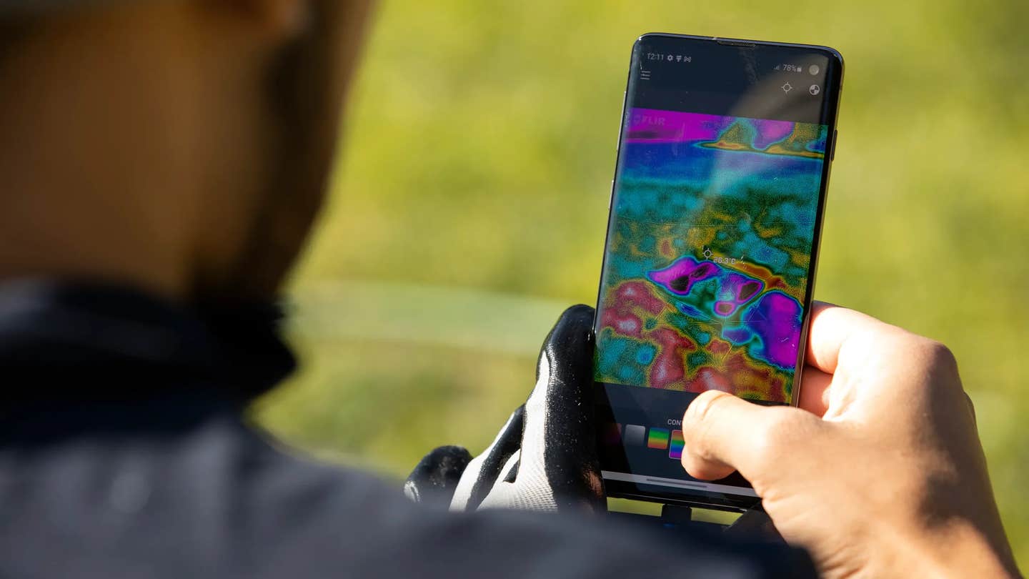
Researchers are using smartphone sensors to predict wildfires, leveraging billions of devices worldwide to improve early warnings and save lives. (CREDIT: Matt Gush/CSUF News Media Services)
Wildfires have surged dramatically in recent years, leaving trails of destruction across continents. In the first eight months of 2017 alone, the United States faced nearly 40,000 wildfires, consuming approximately 2.3 million hectares. That same year, California and Portugal experienced their worst wildfire seasons on record.
In 2019, Australia's severe fires forced water restrictions to preserve resources for firefighting, and California saw wildfire damage exceed $80 billion. By 2023, record-breaking Canadian wildfires sent plumes of smoke drifting over the northeastern United States.
These events underscore the urgent need for enhanced monitoring and forecasting to deliver early warnings and mitigate loss of life and property.
Traditional monitoring relies on weather stations and sensors, providing crucial but limited in situ data. A new frontier in weather data collection is emerging, leveraging the micro-sensors embedded in billions of smartphones globally. These devices, already indispensable to daily life, could transform how we predict and respond to natural disasters, especially wildfires.
Smartphones have become ubiquitous, with over 6.4 billion in use worldwide—more than the number of people with access to electricity or running water in some regions. Their sensors, capable of measuring temperature, humidity, atmospheric pressure, and more, operate continuously, generating vast amounts of environmental data.
Until recently, this data remained untapped. Now, researchers are exploring how it can provide real-time insights into extreme weather conditions, including wildfire risk.
Several studies have already demonstrated the potential of smartphones in environmental research. In the Netherlands, devices have been used to track air pollution, while in the United States, they have helped study atmospheric pressure variability for weather prediction.
Research in the UK and Israel has shown smartphones can reliably map temperature anomalies and atmospheric tides, respectively. These findings highlight smartphones' ability to complement traditional meteorological tools with high spatial and temporal resolution.
Related Stories
Fire weather models depend on parameters like temperature, humidity, wind speed, and precipitation. These factors influence indices such as the Fire Potential Index (FPI) and the vapor pressure deficit (VPD). VPD, a key metric for wildfire risk, measures the dryness of vegetation by assessing the difference between air temperature and humidity.
Studies have linked high VPD levels to extreme fire conditions, as seen in the southwestern United States, where a drought year with record wildfires exhibited significant VPD anomalies.
Tel Aviv University researchers recently developed a methodology using smartphone data to estimate wildfire risk. Data collected via the WeatherSignal app allowed them to calculate VPD across large areas. According to PhD student Hofit Shachaf, VPD reflects vegetation dryness, with higher values indicating increased fire risk.
“In hot and dry atmospheric conditions, more moisture is drawn from plants, facilitating ignition,” Shachaf explained. By harnessing data from billions of smartphones, researchers can calculate VPD at unprecedented spatial and temporal resolutions.
The methodology was tested against two major wildfires: the 2013 Portuguese fire and the 2016 Israeli fires. Smartphone-derived VPD data revealed anomalies leading up to these events, aligning closely with traditional measurements.
Despite individual device errors—such as skewed readings from air conditioning or showers—large datasets allow researchers to filter out anomalies and derive meaningful insights. Calibrating smartphone sensors against commercial meteorological stations further enhances accuracy.
The implications of this approach are profound. Smartphone data offers better coverage than weather stations, particularly in urban areas and low-income regions lacking meteorological infrastructure. As smartphone adoption grows—global coverage has increased by 30% in five years—their data could surpass traditional networks in both reach and resolution.
This research highlights the transformative potential of integrating smartphone data into disaster management. Early warning systems can be improved significantly, enabling authorities to issue timely alerts and take preventative measures. In remote or underserved areas, smartphone sensors could fill critical gaps, helping communities prepare for extreme weather events.
As Prof. Colin Price from Tel Aviv University observed, “Better early warnings could prevent natural hazards from becoming natural disasters.”
Crowdsourced smartphone data represents a vast, untapped resource in the fight against wildfires and other natural disasters. By leveraging this technology, society can better understand, predict, and respond to extreme weather, reducing its devastating impact.
Note: Materials provided above by The Brighter Side of News. Content may be edited for style and length.
Like these kind of feel good stories? Get The Brighter Side of News' newsletter.
Joshua Shavit
Science & Technology Writer | AI and Robotics Reporter
Joshua Shavit is a Los Angeles-based science and technology writer with a passion for exploring the breakthroughs shaping the future. As a contributor to The Brighter Side of News, he focuses on positive and transformative advancements in AI, technology, physics, engineering, robotics and space science. Joshua is currently working towards a Bachelor of Science in Business Administration at the University of California, Berkeley. He combines his academic background with a talent for storytelling, making complex scientific discoveries engaging and accessible. His work highlights the innovators behind the ideas, bringing readers closer to the people driving progress.


