Scientists predict catastrophic river shifts that threaten millions worldwide
Researchers at Indiana University have developed a groundbreaking model to predict river avulsions—sudden, devastating shifts in river courses that can cause catastrophic floods.
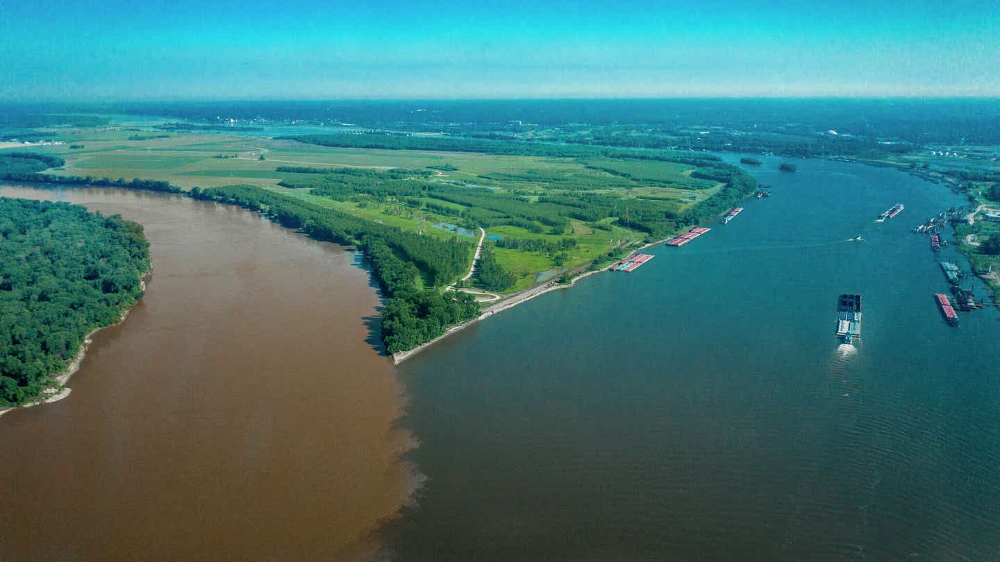
Confluence of Missouri. (left) and Mississippi (Right) rivers near St. Louis Mo. and Alton, Illinois view from Drone shows barges. (CREDIT: Joe Sohm/Visions of America/Universal Images Group via Getty Images)
Indiana University researchers have made significant progress in understanding the dangerous phenomenon known as river avulsion, which refers to the sudden and dramatic shift in a river's course. This shift can cause catastrophic flooding, posing a threat to millions of people around the world.
Their groundbreaking study, published in Nature, sheds light on when and where rivers may be more likely to change direction. This research offers a new predictive model for river avulsions, a process that has shaped human history through devastating floods, such as those seen in Northern India and Pakistan, and continues to present serious risks today.
Led by James “Jake” Gearon, a Ph.D. candidate at Indiana University Bloomington's Department of Earth and Atmospheric Sciences (EAS), the study brings together an interdisciplinary team of researchers, including co-authors Harrison Martin, Clarke DeLisle, Eric Barefoot, and Professor Douglas Edmonds.
Their work provides the first clear framework outlining the conditions under which river avulsions are most likely to occur. Edmonds, the Malcolm and Sylvia Boyce Chair in Geological Sciences at Indiana University, emphasized the historical significance of avulsions: “These events, which likely inspired ancient flood myths, have created the largest floods in human history and continue to threaten millions of people today.”
The research team leveraged satellite technology to improve our understanding of how landscape features affect the likelihood of avulsions. Traditionally, measuring the topography around rivers was a difficult and time-consuming task due to dense vegetation, which obscures the land's surface.
Related Stories
However, the team used a technology known as lidar, a laser-based satellite system, to penetrate vegetation and accurately measure the elevation of the land beneath it. “We took advantage of a new satellite that uses lasers to measure topography,” explained Gearon.
This breakthrough allowed the researchers to produce high-resolution maps, offering a much clearer view of how riverbed elevation and surrounding landscape features combine to trigger avulsions.
What Causes River Avulsions?
River avulsions occur when sediment accumulates in a riverbed, raising the water level above the surrounding landscape. Eventually, the river overflows its banks and carves a new path across the floodplain, potentially flooding areas not designed to handle such high volumes of water.
A dramatic example of this occurred in 2008 when the Kosi River in Northern India experienced an avulsion, displacing over 30 million people, killing hundreds, and causing over $1 billion in damages.
Historically, it was believed that two primary factors caused river avulsions: either the riverbed became elevated above the floodplain, or a steeper path appeared for the water to follow. Edmonds explained that their findings offer new insights: “We can now test these two 80-year-old ideas with the topography data we’ve collected from space. We were surprised to find that both factors work together and play different roles depending on the river’s location.”
This new understanding could revolutionize how we assess flood risks. Avulsions are particularly dangerous because they can occur without warning, even in areas not traditionally considered at risk for flooding. For instance, they can happen in regions that don't experience heavy rainfall but have topographical conditions conducive to sudden river shifts.
Mapping Flood Risk with Avulsion Corridors
The researchers’ next challenge was to predict where future avulsions might occur. By analyzing data from 174 river avulsions worldwide, they identified a pattern: avulsions are more common in regions near mountain ranges and coastal areas, where sediment tends to accumulate more quickly. Seventy-four percent of the events studied occurred in these locations, where rivers are naturally prone to build up sediment and seek out new paths.
The team developed a new model to map potential avulsion pathways, or “avulsion corridors,” which shows where rivers might travel if they break from their current course. This model offers a valuable tool for governments and urban planners to identify areas at high risk for avulsion-related flooding, especially in regions where flood management resources are limited.
Additionally, Gearon highlighted the model's utility in improving flood hazard assessments. "Traditional flood models focus on rising water levels from heavy rains, but avulsions can occur without warning, even in areas where rainfall isn’t a major concern,” he said. “This makes them particularly dangerous and difficult to predict, much like earthquakes.”
Implications for Vulnerable Regions
The new findings carry particularly important implications for regions in the Global South, where river avulsions tend to be more frequent and deadly. Avulsions in areas such as Africa, Latin America, and Asia can result in large-scale displacement and loss of life due to the combination of geological conditions and limited infrastructure. The 2010 avulsion-related floods in Pakistan, for example, affected over 20 million people, demonstrating the severe human impact these events can have in underprepared regions.
This new avulsion mapping model could offer life-saving information for governments and communities in vulnerable areas, helping them prepare for potential disasters. Because the model requires relatively minimal data, it could be applied in areas with limited resources or access to sophisticated flood prediction technologies. As climate change continues to intensify, altering global weather patterns and increasing the likelihood of floods, the ability to predict avulsions becomes even more critical.
A Crucial Tool for Future Planning
The study presents a crucial new approach to flood hazard assessments, addressing a gap in existing flood models. While traditional models primarily focus on predicting floods caused by rising water levels from rainfall, the unpredictable nature of avulsions has long been a challenge for scientists and policymakers.
The ability to accurately predict where avulsions may occur offers a way forward in mitigating these often-devastating events. As Gearon noted, “Understanding and predicting avulsions has never been more critical.”
By offering a new framework for predicting these sudden changes in river courses, the researchers hope to provide policymakers and planners with a more complete picture of flood risks. This is especially important as human populations continue to expand into flood-prone areas, and climate change exacerbates the intensity and frequency of flooding events worldwide.
Note: Materials provided above by The Brighter Side of News. Content may be edited for style and length.
Like these kind of feel good stories? Get The Brighter Side of News' newsletter.
Joshua Shavit
Science & Technology Writer | AI and Robotics Reporter
Joshua Shavit is a Los Angeles-based science and technology writer with a passion for exploring the breakthroughs shaping the future. As a contributor to The Brighter Side of News, he focuses on positive and transformative advancements in AI, technology, physics, engineering, robotics and space science. Joshua is currently working towards a Bachelor of Science in Business Administration at the University of California, Berkeley. He combines his academic background with a talent for storytelling, making complex scientific discoveries engaging and accessible. His work highlights the innovators behind the ideas, bringing readers closer to the people driving progress.