New climate model significantly improves prediction of life-threatening rainfall events
Breakthroughs in forecasting extreme rainfall aim to improve early warnings and save lives as flash floods intensify due to climate change.

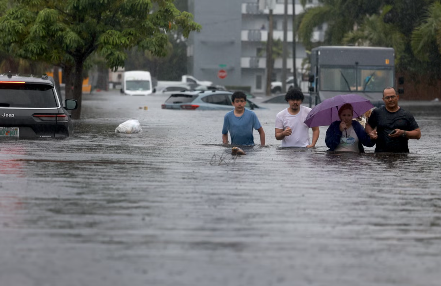
Scientists are developing advanced tools to predict extreme rainfall and flash floods, addressing the growing risks posed by climate change-induced weather events. (CREDIT: Getty Images)
Extreme rainfall events are intensifying worldwide, posing significant threats to human lives, infrastructure, and ecosystems. While urbanization, land-use changes, and reliance on critical infrastructure exacerbate these risks, the unpredictability and localized nature of flash floods make them especially dangerous.
Scientists warn that the frequency and intensity of such events are growing due to climate change, amplifying their destructive potential.
Understanding the Science Behind Extreme Rainfall
Heavy rainfall occurs when the atmosphere holds and releases large amounts of moisture. The Clausius-Clapeyron equation predicts that atmospheric moisture capacity increases by 6–7% for every degree Celsius of warming.
However, recent studies, published in the journal, Weather and Climate Extremes, reveal that short-duration rainfall intensities, such as those observed during severe convective storms, often exceed these predictions, exhibiting "super Clausius-Clapeyron" behavior. This phenomenon, where rainfall increases at rates twice as high as expected, highlights the critical role of storm dynamics.
Convective storms, particularly supercells and mesoscale convective systems (MCS), are among the most potent drivers of flash floods. Supercells, characterized by rotating updrafts called mesocyclones, can produce extreme rainfall in a short period.
In contrast, MCS events, known for their slow movement and repetitive rain over the same area, can lead to prolonged flooding. Vertical wind shear plays a pivotal role in storm organization, further influencing rainfall intensity and predictability.
Real-World Consequences
The devastating impacts of extreme rainfall have been felt worldwide. In Germany, catastrophic flash floods in 2021 claimed lives and destroyed property, while Libya's Derna dam failure in 2023 resulted in over 11,000 fatalities. Similar events in Greece and Italy underscored the universal vulnerability to these disasters, regardless of a country’s wealth or infrastructure.
Recent observations confirm that climate change contributes to rainfall intensification. Studies link these changes to rising global temperatures and the dynamic processes within storms.
Related Stories
For instance, the 400 mm of rain that fell in just three hours in Marche, Italy, exemplifies the dangers of high-intensity, short-duration rainfall. Such events highlight the urgent need for improved forecasting and early warning systems.
A Breakthrough in Prediction
Scientists from institutions including the Met Office and Newcastle University have developed a groundbreaking conceptual model to enhance the prediction of life-threatening rainfall events. Their research identifies a distinctive three-layered atmospheric structure critical for extreme rainfall.
This structure consists of Moist Absolute Unstable Layers (MAULs) sandwiched between a stable upper layer and a near-stable lower layer. These findings provide a new framework for understanding the thermodynamics of extreme rainfall and offer a pathway to better forecasting.
Paul Davies, a leading researcher at the Met Office, emphasized the importance of this discovery: “The new model is aimed at enhancing the UK’s resilience to extreme weather events, which are becoming more frequent and intense due to climate change. This approach addresses the urgent need for improved prediction capabilities and will help both UK and global communities mitigate the risks associated with increasingly extreme weather events.”
Hayley Fowler, a climate change impacts expert at Newcastle University, echoed this sentiment, stating, “This research represents a paradigm shift in thinking about extreme rainfall processes. Developing this model into an operational system will align with the UN’s ‘Early Warnings for All’ initiative, aiming for universal protection from hazardous weather by 2027.”
Challenges and Future Directions
Despite advancements in high-resolution numerical weather models, forecasting short-duration extreme rainfall remains a significant challenge. Predicting the complex processes behind storm dynamics and thermodynamics is particularly difficult. Supercells, back-building storms, and slowly moving MCS events require nuanced understanding and localized knowledge to anticipate their impacts accurately.
Orographic features—such as mountains and valleys—add another layer of complexity. These geographical characteristics can enhance rainfall through orographic lifting, leading to greater runoff and increased flood risks. Successful predictions must integrate detailed knowledge of regional topography with advanced modeling techniques.
To address these challenges, researchers propose a novel “ingredients-based” forecasting method. This approach identifies the key atmospheric conditions conducive to extreme rainfall, offering forecasters tools to better anticipate high-risk scenarios. By analyzing historical rainfall data and simulating storm behaviors, this method aims to improve early warnings for vulnerable communities.
The study’s conceptual model also incorporates large-scale atmospheric patterns, such as Omega blocks and Rex Vortex couplets, which provide optimal conditions for sub-hourly rainfall extremes. These insights could form the basis of a “four-stage warning system” to help meteorologists deliver timely and accurate alerts.
As global warming accelerates, the intensification of the water cycle underscores the need for robust early warning systems. Accurate predictions can save lives and bolster public confidence in meteorological services. The recent advancements in understanding extreme rainfall offer hope for a more prepared future.
By combining cutting-edge research with operational forecasting tools, scientists aim to reduce the surprises associated with flash floods.
The ultimate goal is to provide communities with the time and information needed to prepare for these increasingly common and devastating events.
Note: Materials provided above by The Brighter Side of News. Content may be edited for style and length.
Like these kind of feel good stories? Get The Brighter Side of News' newsletter.
Rebecca Shavit
Science & Technology Journalist | Innovation Storyteller
Based in Los Angeles, Rebecca Shavit is a dedicated science and technology journalist who writes for The Brighter Side of News, an online publication committed to highlighting positive and transformative stories from around the world. With a passion for uncovering groundbreaking discoveries and innovations, she brings to light the scientific advancements shaping a better future. Her reporting spans a wide range of topics, from cutting-edge medical breakthroughs and artificial intelligence to green technology and space exploration. With a keen ability to translate complex concepts into engaging and accessible stories, she makes science and innovation relatable to a broad audience.


