Researchers uncover prehistoric landscape buried beneath Antarctica
Antarctica’s ancient river networks buried beneath ice, reveal insights into prehistoric climates and future climate change impacts.

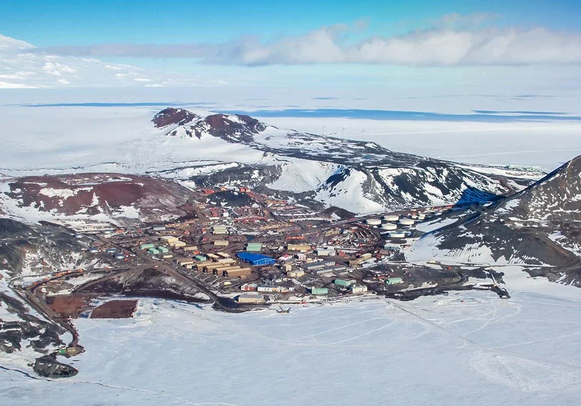
The East Antarctic Ice Sheet, a vast expanse spanning over 10 million square kilometers, has long concealed a landscape millions of years old. (CREDIT: CC BY-SA 4.0)
The East Antarctic Ice Sheet, a vast expanse spanning over 10 million square kilometers, has long concealed a landscape millions of years old.
Thanks to satellite technology and groundbreaking geophysical research, scientists have pierced through the icy veil to uncover a relic from an era when Antarctica teemed with river networks and lush vegetation.
This discovery not only offers a glimpse into Earth’s prehistoric past but also provides critical insights into how the continent may respond to modern climate challenges.
A Hidden Landscape Revealed
Researchers, led by Stewart Jamieson of Durham University, used advanced satellite imaging to uncover an ancient terrain buried beneath nearly two kilometers of ice.
This fossilized landscape, roughly the size of Wales, was revealed through the innovative use of RADARSAT, a Canadian satellite constellation capable of detecting subtle variations in the ice surface that hint at the contours below.
Jamieson describes the process as “like uncovering a time capsule.” The terrain’s survival under such immense ice suggests its remarkable antiquity.
Carved by rivers before the ice sheet grew, this landscape likely dates back over 34 million years. It provides a snapshot of an Antarctica that once thrived as part of the supercontinent Gondwana, where dinosaurs roamed a verdant expanse before the continent succumbed to glaciation around 20 million years ago.
"We’ve had a longtime interest in, effectively, the shape of the land beneath the ice sheet," Jamieson said. "The implication is that this must be a very old landscape carved by rivers before the ice sheet itself grew."
From Gondwana to Glaciation
The East Antarctic Ice Sheet (EAIS) began forming during the Eocene-Oligocene transition around 34 million years ago, as global temperatures plummeted and CO2 levels dropped below a critical threshold.
High-altitude regions such as the Gamburtsev Subglacial Mountains and Transantarctic Mountains became nuclei for the growing ice masses. Over millions of years, these glaciers expanded, eventually coalescing into the massive ice sheet that persists today.
Related Stories
The EAIS has undergone significant fluctuations throughout its history. During the Miocene, approximately 17 to 14 million years ago, the ice sheet expanded and retreated in response to climatic shifts.
Evidence from marine sediments suggests periods of retreat during warmer intervals, such as the mid-Pliocene warm period and the interglacial periods of the Pleistocene. These fluctuations left lasting imprints on the subglacial landscape, shaping features that are now detectable through modern geophysical surveys.
Satellite Technology and Geophysical Surveys
The RADARSAT constellation has been instrumental in uncovering these hidden features. By analyzing changes in ice surface slope, researchers can infer the large-scale subglacial topography.
Jamieson’s team complemented this data with radio-echo sounding (RES) surveys conducted as part of the International Collaborative Exploration of the Cryosphere through Airborne Profiling (ICECAP) project.
Using RES, researchers quantified the landscape characteristics and identified ancient topographic features inconsistent with current ice flow patterns. The findings suggest a landscape shaped by fluvial erosion long before the ice sheet’s formation.
The team also applied flexural modeling to evaluate whether highland blocks beneath the ice were once part of a single land surface, subsequently incised and uplifted by selective erosion. These analyses reveal a more detailed picture of how the EAIS evolved and the role of ancient river networks in shaping its underlying terrain.
Implications for Climate Science
Understanding the history of the EAIS has profound implications for predicting its future behavior in a warming world. The ice sheet’s sensitivity to climatic and oceanic changes makes it a critical indicator of how rising temperatures might reshape the polar regions.
Jamieson’s research, published in the journal Nature Communications, underscores the importance of studying subglacial landscapes to reconstruct the ice sheet’s past dynamics. "Understanding how this massive sheet might respond to human-driven climate change is a pressing concern," he emphasized.
The EAIS, particularly in low-lying marine-based sectors like the Aurora and Wilkes Subglacial Basins, is vulnerable to retreat during warm intervals. Such changes could contribute significantly to global sea-level rise.
The team’s findings highlight the need for continued monitoring of the EAIS and its response to current warming trends. By linking ancient landscape features to past climate conditions, researchers can refine models predicting the ice sheet’s future behavior. This knowledge is vital for informing global strategies to mitigate the effects of climate change.
Bridging Eras: Lessons from the Past
The discovery of Antarctica’s ancient river networks is a testament to the power of modern technology to illuminate Earth’s distant past. By piecing together clues from subglacial topography and geological records, scientists are bridging millions of years to connect prehistoric landscapes with today’s climate dynamics.
The insights gained from this research extend beyond academic curiosity. They underscore the interconnectedness of Earth’s past, present, and future. The geological imprints of ancient Antarctica offer valuable lessons for understanding current environmental changes and forecasting the global impact of human-driven climate change.
As humanity grapples with the challenges of a warming world, the knowledge embedded in Antarctica’s icy depths will play a crucial role in guiding efforts to sustain the planet’s delicate ecosystems. This discovery is a poignant reminder of Earth’s dynamism and the transformative processes that have shaped it over millennia.
By studying the buried landscapes of Antarctica, researchers are constructing a clearer picture of our planet’s climatic future and the pathways needed to adapt to a rapidly changing environment.
Note: Materials provided above by The Brighter Side of News. Content may be edited for style and length.
Like these kind of feel good stories? Get The Brighter Side of News' newsletter.
Joseph Shavit
Head Science News Writer | Communicating Innovation & Discovery
Based in Los Angeles, Joseph Shavit is an accomplished science journalist, head science news writer and co-founder at The Brighter Side of News, where he translates cutting-edge discoveries into compelling stories for a broad audience. With a strong background spanning science, business, product management, media leadership, and entrepreneurship, Joseph brings a unique perspective to science communication. His expertise allows him to uncover the intersection of technological advancements and market potential, shedding light on how groundbreaking research evolves into transformative products and industries.


